Many regions of the United States are projected to experience higher temperatures, more extreme heat events, and an intensifying hydrologic cycle with more frequent and severe storms and droughts. These climatic changes, coupled with accelerating land use and land cover change, are expected to result in dramatic and complex shifts in how watersheds function and the vital ecosystem services they provide. An improved understanding of the dominant processes controlling watershed hydro-biogeochemical function across a range of hydrologic regimes and land covers is necessary to better predict the interactive consequences of hydrologic intensification and land cover change at regional scales. Oak Ridge National Laboratory’s Watershed Dynamics and Evolution (WaDE) SFA is addressing critical knowledge gaps related to how watershed function responds to exogenous change using stream metabolism, a gauge of the rates of production and consumption of organic compounds, as an integrated measure of watershed function. This research is focused on representative watersheds with heterogenous land cover within the Tennessee River Basin, initially East Fork Poplar Creek (EFPC), Tennessee.
The IDEAS-Watersheds project is partnering with the WaDE SFA to develop key capabilities needed to support the SFA’s goal of improved understanding of stream metabolism in partially urbanized watersheds. The partnership is implementing a high-resolution flow and reactive transport model for EFPC using the ATS and PFLOTRAN codes from the IDEAS-Watersheds software ecosystem. The models incorporate subgrid representations of oxygen dynamics that build on multiscale reactive transport capabilities developed previously in IDEAS-Watersheds. We will use measurements of oxygen dynamics from the WaDE SFA’s sensor network to evaluate and refine the model. The partnership is also adding the capability to model burial, resuspension, and transport of sediment-associated solutes to the ATS. This capability is of interest because carbon, nutrients and trace elements move through aquatic ecosystems with suspended sediment.
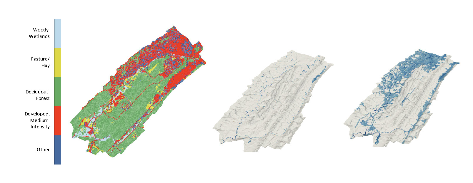
Image: Left: Land cover map for East Fork Poplar Creek, Tennessee, Watershed showing medium intensity development in the headwater regions and deciduous forest downstream. Middle and right: ATS-simulated ponded surface water before (middle) and during (right) a storm event. Inundation patterns during the storm event reflect the pattern of developed land. Image credit: Saubhagya Rathore, ORNL.